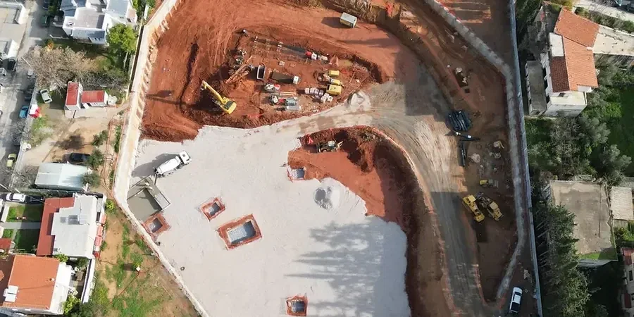
With Wagga Wagga’s elevation sitting around 180 metres above sea level and its urban core expanding along the Murrumbidgee River floodplain, deep excavation projects here face a distinct set of subsurface challenges that generic designs simply cannot address. The city’s population has grown steadily past 70,000, driving demand for multi-level basements and below-grade infrastructure, yet the alluvial clays and sands that define much of the central Wagga Wagga basin introduce real complexity around lateral earth pressures and groundwater cut-off. A geotechnical design of deep excavations developed specifically for Wagga Wagga conditions integrates the site’s stratigraphy with a retention strategy that keeps adjacent roads and heritage buildings stable throughout the dig. Whether the project involves a cut-and-cover tunnel section or a two-level basement adjacent to Fitzmaurice Street, the design must anticipate how the Murrumbidgee’s historic flood deposits will behave once dewatered and temporarily exposed. For deeper cuts where SPT refusal is shallow, we often couple the excavation design with a prior CPT test campaign to map continuous strength profiles before finalising the shoring geometry.
Designing a deep excavation in Wagga Wagga means accounting for the Murrumbidgee alluvium’s dual personality: stiff in summer, but demanding active dewatering and face protection the moment autumn rains arrive.
Technical details of the service in Wagga Wagga
Critical ground factors in Wagga Wagga
AS 4678 provides the performance framework, but in Wagga Wagga the real risk driver is the interaction between groundwater and the alluvial sand lenses that underlie much of the CBD. These lenses, deposited by the Murrumbidgee River over successive flood cycles, are often confined or semi-confined, meaning that a deep excavation can trigger hydraulic uplift or piping at the base if the cut penetrates the overlying clay seal without sufficient relief. A geotechnical design of deep excavations must therefore include a detailed groundwater model calibrated to local borehole data, because the consequences of a base heave failure in Wagga Wagga’s commercial district extend well beyond the site boundary. Add to this the vibration sensitivity of century-old masonry structures along Baylis Street, and the design brief expands to include pre-construction condition surveys and vibration-triggered monitoring plans. Our practice embeds these risk controls early, running sensitivity analyses that define trigger levels for dewatering rates and wall deflection before the first bucket enters the ground.
Our services
The geotechnical design of deep excavations we deliver in Wagga Wagga is structured around the specific retention and groundwater challenges of the Riverina, with each service calibrated to the AS 4678 framework and local council requirements.
Shoring System Design and Analysis
Full design of soldier pile, secant pile, diaphragm wall, or soil nail retention systems using limit equilibrium and finite element methods, with wall deflection and bending moment envelopes reported per AS 4678.
Construction-Phase Dewatering Design
Hydrogeological modelling and dewatering system specification for excavations penetrating the Murrumbidgee alluvial aquifer, including recharge system design to protect adjacent structures from settlement.
Excavation Impact Assessment
Prediction of ground movements behind the retention wall and assessment of impact on adjacent buildings, utilities, and roadways within Wagga Wagga’s CBD, with settlement contours and damage classification.
Instrumentation and Monitoring Plans
Specification of inclinometer, piezometer, and survey monitoring arrays with trigger-based response protocols aligned to the excavation’s risk profile and council permit conditions.
Top questions
How much does a deep excavation design for a Wagga Wagga project typically cost?
For a geotechnical design of deep excavations in Wagga Wagga, fees generally range from AU$3,620 to AU$13,700 depending on the complexity of the retention system, the depth of the cut, and the level of groundwater modelling required. A straightforward single-level basement on a suburban lot sits at the lower end, while a multi-level excavation in the CBD with adjacent heritage structures and full hydrogeological analysis occupies the upper range. We provide a fixed-fee proposal after reviewing your site investigation data and concept plans.
What retainage system works best for the Wagga Wagga alluvial soils?
The optimal system depends on depth and proximity to the Murrumbidgee floodplain, but in Wagga Wagga’s mixed alluvial profile we frequently specify soldier pile and lagging walls for cuts up to about 6 metres, transitioning to secant pile or diaphragm walls when groundwater cut-off is required at greater depth. Soil nailing can be effective in the stiffer residual clays found on the higher ground south of the CBD, provided the face is protected against weathering during construction. Every design is matched to the specific stratigraphy encountered in the boreholes, with the retention type selected to limit ground loss in the loose sand lenses that are common beneath the city centre.
How long does the design and approval process take for a deep excavation in Wagga Wagga?
Once the geotechnical investigation data is complete, the design phase typically runs three to five weeks, encompassing shoring analysis, dewatering design, and preparation of construction-phase monitoring specifications. The subsequent approval timeline with Wagga Wagga City Council varies depending on whether the project triggers a Development Application with excavation impact assessment, but we manage the technical submission package to minimise information requests and keep the process moving.