The Murrumbidgee River floodplain masks what lies beneath Wagga Wagga. Alluvial clays, sands, and gravels shift across short distances here. We run VES surveys because drilling alone misses the lateral picture. A single resistivity line can track a paleochannel under a proposed warehouse pad without putting a rig on it. Data feeds directly into earthworks planning and cut-fill balance. For sites near the river's old meanders, we often pair resistivity with test pits to ground-truth the geoelectric sections at key tie points before excavation starts.
Resistivity contrast between saturated alluvium and dry overburden can exceed 10:1. That's what makes VES work so well on the Murrumbidgee floodplain.
Technical details of the service in Wagga Wagga
Critical ground factors in Wagga Wagga
Wagga Wagga has grown westward onto former grazing land where old creek lines were filled decades ago. Those buried channels don't appear on standard borehole logs unless you hit them by chance. We've seen a 12-metre-wide silt-filled paleochannel cross a Bomen industrial lot undetected. Resistivity profiling flagged it in one afternoon. The alternative? A grid of boreholes costing five times more and still possibly missing the feature. In the city's south, rising groundwater salinity—conductivities above 3,000 µS/cm are common—creates a strong electrical contrast that VES picks up clearly. Ignoring this means differential settlement risk under slab-on-ground construction. The survey pays for itself the first time you avoid over-excavation.
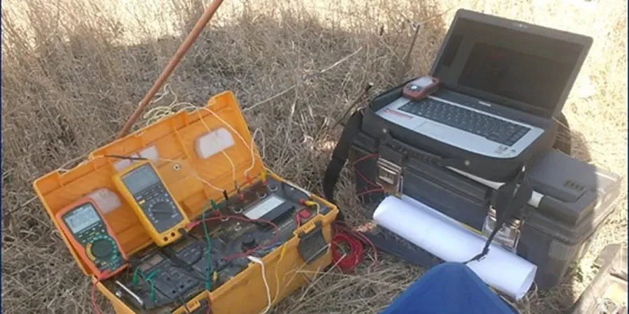
Our services
We run two types of electrical surveys in the Wagga Wagga region. Each targets a different investigation scale and depth range.
Vertical Electrical Sounding (VES)
Point-based 1D depth investigation. We expand electrode spacing stepwise at a fixed centre point. Best for estimating depth to bedrock, mapping water table, or identifying clay layer thickness beneath a single building footprint.
2D Electrical Resistivity Tomography (ERT)
Multi-electrode profile along a line. We use 48 to 72 electrodes with automatic switching. Produces a continuous resistivity cross-section. Suited for pipeline routes, levee investigations, and paleochannel detection along proposed road alignments.
Top questions
What depth can a VES survey reach in Wagga Wagga soils?
With a 200 m AB/2 spread, effective penetration reaches 50 to 75 metres depending on subsurface resistivity. Dry surface layers reduce current penetration; we extend spreads when needed. In saturated alluvium near the Murrumbidgee, depth of investigation improves significantly.
How much does an electrical resistivity survey cost in Wagga Wagga?
A single VES sounding typically runs between AU$930 and AU$1,740. A 2D ERT profile with 48 electrodes costs more due to field time and data processing. The final figure depends on site access, spread length, and number of soundings or profiles required.
Will a resistivity survey work after heavy rain?
Yes, and in some cases it helps. Wet ground improves electrode coupling and reduces contact resistance. Saturated near-surface layers also increase the conductivity contrast with resistive bedrock. We do avoid surveying during active thunderstorms for safety. Light rain does not stop the work.